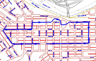
If you look closely at this map of the downtown area of Mankato, one of the first things that you will notice is that the "original" plat of the city was laid out essentially at right angles to the point on the Minnesota River where it bends away to the North.
Directions from the MSU Campus:
Follow Val Illm Drive into warren Street. Where Warren turns into a one-way street, bear slightly to the right (not a hard right). At the stop sign, turn left onto Cherry Street, (the Blue Earth Historical Society is the building on the left corner), at the next street (Fourth Street), turn right. Go halfway down the block to Jackson Street. You can park on either side of the street without a permit in this area.
Now follow the map found in the walking tour booklet.


No comments:
Post a Comment